Site Logo

Rio Reimagined

We Want Your Feedback!​

Please take a few minutes to complete the survey and share your perspective.

Introduction

The Maricopa Association of Governments (MAG) Rio Reimagined Active Transportation Study’s purpose is to establish a unified vision for a regional multi‑use trail connecting communities along the Rio Salado and Gila River corridors spanning roughly 90 miles through six member cities, unincorporated Maricopa County, and two Native Nations. The plan will identify a preferred active transportation alignment along the river and offer strategies to help jurisdictions plan, prioritize, and fund projects in order to meet the active transportation needs of current and future valley residents

MAG provides regional planning and policy decisions of the greater Phoenix region and its mission is to serve as a forum for local governments to work together on issues that cross city and county borders. The Rio Reimagined Active Transportation Study embodies that mission. It is about more than creating trails, it is about creating a shared experience and strengthening the connection between people, communities, and the Salt and Gila Rivers. Cross-agency investments have the potential to expand transportation choices, support local economies, improve health, and celebrate the unique natural and cultural heritage of the region. Shaped through collaboration with communities, agency partners, and stakeholders, the following vision and goals provide the foundation for shaping a more connected, accessible, safe, sustainable, and economically stronger region for generations to come. This study defines opportunities, challenges, and recommendations for the next 10 years and beyond and is meant to be carried out by the agencies within the corridor.

The Study's Vision

The Rio Reimagined Active Transportation Study aims to transform the Salt and Gila Rivers corridors into the region’s premier active transportation network. The corridor is both infrastructure and destination, linking neighborhoods, job centers, and cultural hubs.

Walkers, bicyclists, and micromobility (small, lightweight vehicles such as electric scooters) users will find safe, accessible, and equitable options that make multimodal transportation practical and appealing at a regional scale, reimagining how people move through the Valley.

Through intentional design, it will reconnect people to the natural landscape and to each other. In doing so, the plan becomes a catalyst for healthier lifestyles, sustainable growth, and a connected region.  

Guiding Principles

Study Goals

Connectivity and Access

Establish a Seamless Corridor
Establish a continuous 90-mile network along the Salt and Gila Rivers for walking, biking, and micromobility that connects communities across the region.

Expand Access
Provide transportation options for varied communities with diverse needs and further support connections to transit, jobs, schools, and essential services.

Environmental Stewardship

Protect and Connect People to Nature
Enable easy, everyday access to nature while fostering environmental stewardship and protecting the river ecosystem as well as its natural beauty.

Address Climate
Incorporate shade and cooling to enable practical year-round use.

Safety and User Experience

Prioritize Safety for All Users
Design low-stress, accessible, protected facilities safe for all users.

Design for Climate
Create a corridor that us usable year-round through use of shade, cooling infrastructure, and climate-responsible design supporting the region’s sustainability goals.

Promote Health
Encourage active everyday travel.

Economic and Regional Impact

Support Economic Growth
Enhance access to businesses and catalyze corridor-based development.

Create a Regional Destination
Establish the corridor as a landmark for the Valley that is well-branded, recognizable, and memorable, drawing residents and visitors alike.

Benefit of Trails and Project Need

Across the country, metropolitan regions are making significant investments in regional trail systems because of their wide-ranging benefits. A well-connected trail network enhances regional quality of life by providing safe and accessible opportunities for walking, bicycling, and outdoor recreation while linking neighborhoods, schools, parks, activity centers, and commercial districts. High-profile examples include Atlanta’s BeltLine, Houston’s Bayou Greenways, the San Francisco Bay Area Trail, and The Chuck Huckleberry Loop in Tucson. Planned and constructed over many years, these systems have become defining regional assets that have generated substantial economic, recreational, and community benefits.

Closer to home, Scottsdale’s Indian Bend Wash Greenbelt demonstrates the long-term value of an interconnected trail system, serving as a recreational amenity, transportation corridor, and catalyst for economic development. As communities throughout the region continue to expand and enhance their own trail and pathway networks, the Rio Reimagined Shared-Use Path will play a critical role in connecting these systems. By linking communities to one another and to the natural and recreational resources along the Salt and Gila rivers, the project will help create a more cohesive local and regional trail network.

The benefits of trails and pathways are extensive and well documented.

Key benefits include:

Active Transportation

Trails and pathways provide safe and convenient alternatives to driving by creating dedicated routes for walking, bicycling, and other forms of non-motorized travel. These off-street facilities are often preferred over roadways with high traffic volumes and speeds and are an important component of an All Ages and Abilities transportation network. By making active transportation more comfortable and accessible, trails can reduce vehicle trips, ease congestion, and contribute to improved air quality.

Connectivity

Trails and pathways connect people to destinations and to one another. They improve access to neighborhoods, parks, schools, workplaces, shopping areas, cultural destinations, and recreational amenities. Increased connectivity promotes social, physical, and economic activity while helping create a more cohesive and accessible community.

Quality of Life

A well-connected trail network enhances quality of life by providing safe and accessible opportunities for walking, bicycling, and outdoor recreation while linking neighborhoods, schools, parks, employment centers, and commercial districts. Trails and pathways also foster social interaction, strengthen community identity, and create meaningful connections between people and places, helping build a stronger sense of belonging and civic pride.

Environment

Trails and shared-use paths provide important environmental benefits by encouraging walking, bicycling, and other forms of active transportation, reducing vehicle miles traveled and associated greenhouse gas emissions. Trails also preserve open space and natural areas, helping protect wildlife habitat, improve air and water quality, and promote more sustainable land use patterns.

Health

Trails and pathways encourage regular physical activity by providing safe, convenient spaces for walking, running, bicycling, and other forms of exercise. By making recreation and active transportation more accessible, they help improve cardiovascular health, reduce the risk of chronic disease, and support both physical and mental well-being for residents of all ages.

Economic Development and Tourism

Trails and pathways create significant economic value by making communities more attractive places to live, work, and invest. Well-connected trail systems can stimulate redevelopment and private investment, as residents and businesses increasingly seek locations with access to outdoor recreation and active transportation options. Trails also attract visitors and tourism-related spending, generating revenue for local businesses such as restaurants, lodging establishments, retail shops, and recreation providers. In addition, proximity to trails has been shown to support higher property values and contribute to long-term regional economic vitality.

Active Transportation Trends

Active transportation is the movement of people through non-motorized forms of travel, typically referring to people walking, biking, and rolling. Communities across the Valley have been investing in active transportation as residents increasingly express interest in walking and biking for recreational and other trips. Over the past decade, electric bikes (e-bikes) have grown in popularity and are leading to even more trips completed by bicycle. 

As interest in active transportation has grown, it is even more important to design bicycle and pedestrian facilities to be safe and enjoyable.  Focusing on safety for people walking and biking, particularly as it relates to interactions with motorized vehicles, inevitably leads to more enjoyable and comfortable experiences that encourage more people to walk and bike.

There are several important active transportation principles that should guide design of connections to amenities within the Rio Corridor, referred to later in this plan as Priority Bicycle Corridors.

As we design bicycle and pedestrian facilities, we want to create an experience that is safe and comfortable for a wide spectrum of people, including children and seniors. This involves thinking about the number of vehicles, travel speeds, and number of vehicular lanes and design process weighs these factors and attempts to mitigate safety issues and enhance user comfort through shared-use paths, protected bike lanes, and other intentional features. The goal is to reduce the “stress” that a person walking and biking feels as much as possible, and by doing so, we can encourage more people to walk and bike.

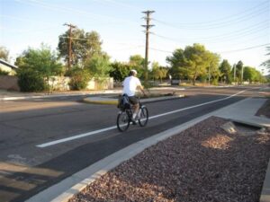
Separation can be incorporated in several different ways, including buffers between drivers and cyclists, vertical separation using concrete curbs and other vertical elements, or by fully moving a cyclist to an adjacent shared-use path on the busiest and highest speed roadways.

Bicycle separation and creating All Ages and Abilities connections between neighborhoods and the Rio Corridor should be prioritized on Priority Bicycle Corridors described in this plan.

These alternative routes, called parallel routes, typically leverage collector roadways and neighborhood streets with far fewer vehicles and slower speeds to make important connections, still following All Ages and Abilities principles.

Priority Bicycle Corridors described in this plan are focused on arterial roadways, but lower stress, parallel routes should be considered and preferred when they can offer the same connectivity benefits of linking neighborhood areas to Rio Corridor trails and amenities.

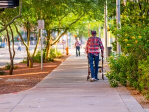
Person walking along sidewalk off of a busy street in a city. The sidewalk is surrounded by green and flowering bushes, above the walkway are trees lining the path to provide shade.

Shade can be provided through native trees and vegetation that can mitigate heat exposure, especially during warmer months. Shade sails and similar elements are also increasingly included in areas with higher volumes of pedestrians and cyclists.

Additional amenities like bike repair stations and bicycle parking can also provide reassurance to cyclists.

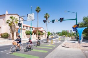
As we design bicycle and pedestrian facilities, we want to create an experience that is safe and comfortable for a wide spectrum of people, including children and seniors. This involves thinking about the number of vehicles, travel speeds, and number of vehicular lanes and what the experience of someone walking and biking might be on that roadway.  The design process weighs these factors and attempts to mitigate safety issues and enhance user comfort through shared-use paths, protected bike lanes, and other intentional features. The goal is to reduce the “stress” that a person walking and biking feels as much as possible, and by doing so, we can encourage more people to walk and bike.Two adults and Two children riding down street in bike lane. On other side of street, houses line the path surrounded by palm trees.
Incorporating bicycle separation techniques is a cornerstone of the All Ages and Abilities concept described previously and helps to create space and separation between people driving and those walking and biking. Separation can be incorporated in several different ways, including buffers between drivers and cyclists, vertical separation using concrete curbs and other vertical elements, or by fully moving a cyclist to an adjacent shared-use path on the busiest and highest speed roadways. Bicycle separation and creating All Ages and Abilities connections between neighborhoods and the Rio Corridor should be prioritized on Priority Bicycle Corridors described in this plan.
In some cases, bicycle travel on roadways with high volumes and speeds of vehicular traffic should be avoided, especially when nearby roadways can provide the same connection through a lower stress experience for the person biking.  These alternative routes, called parallel routes, typically leverage collector roadways and neighborhood streets with far fewer vehicles and slower speeds to make important connections, still following All Ages and Abilities principles. Priority Bicycle Corridors described in this plan are focused on arterial roadways, but lower stress, parallel routes should be considered and preferred when they can offer the same connectivity benefits of linking neighborhood areas to Rio Corridor trails and amenities.
Heat exposure is becoming an increasingly critical component of bicycle and pedestrian facility design. In addition to making walking and biking safer by increasing separation between people driving and biking, shade and amenities also play a critical role in encouraging walking and biking. Shade can be provided through native trees and vegetation that can mitigate heat exposure, especially during warmer months. Shade sails and similar elements are also increasingly included in areas with higher volumes of pedestrians and cyclists. Additional amenities like bike repair stations and bicycle parking can also provide reassurance to cyclists.Person walking along sidewalk off of a busy street in a city. The sidewalk is surrounded by green and flowering bushes, above the walkway are trees lining the path to provide shade.

Contact Us

MAG Logo

For more information, please call Maricopa Association of Governments.

602-254-6300  |   [email protected]

Click here for more information.

We Want Your Input!

Please take a few minutes to complete the survey and share your perspective.