
Our Mission
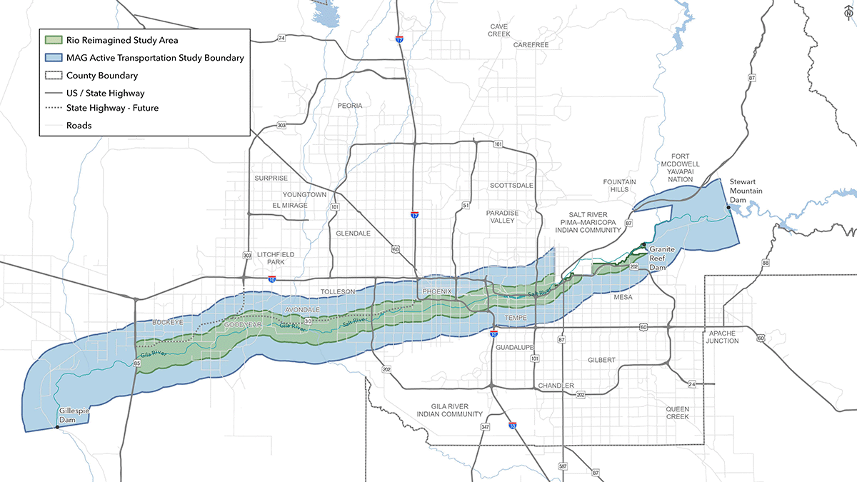
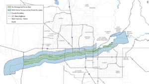
The Rio Reimagined Active Transportation Study aims to transform the Salt and Gila River corridor into the region’s premier active transportation network. The corridor is both infrastructure and destination, linking neighborhoods, job centers, and cultural destinations.
Page Sections:
Our Goals

Lorem ipsum dolor sit amet, consectetur adipiscing elit. Ut elit tellus, luctus nec ullamcorper mattis, pulvinar dapibus leo.

Lorem ipsum dolor sit amet, consectetur adipiscing elit. Ut elit tellus, luctus nec ullamcorper mattis, pulvinar dapibus leo.

Lorem ipsum dolor sit amet, consectetur adipiscing elit. Ut elit tellus, luctus nec ullamcorper mattis, pulvinar dapibus leo.

Lorem ipsum dolor sit amet, consectetur adipiscing elit. Ut elit tellus, luctus nec ullamcorper mattis, pulvinar dapibus leo.
About the Study
The Rio Reimagined corridor is connected to an extensive network of regional trails that provide access to communities, employment centers, recreational destinations, parks, and open space areas throughout Maricopa County. Among the most significant of these connections are the Sun Circle Trail and Maricopa Trail, two regional trail systems that intersect the study area at multiple locations and function as a highly interconnected network spanning
much of the Valley.
The Sun Circle Trail
Located in the West Valley, this trail enters the study area from the north along Avondale Boulevard in Avondale and extends south to the Monument Hill Trailhead near the Base and Meridian Wildlife Area. At this location, the Sun Circle Trail connects with the Maricopa Trail before continuing east along portions of the Salt River corridor through Phoenix. The trail provides access to destinations including the Tres Rios Wetlands and continues southeast toward South Mountain Park and Preserve. Beyond the study area, the Sun Circle Trail continues east through Tempe, Chandler, and Gilbert before connecting with the Consolidated Canal Trail. The Consolidated Canal Trail extends north into and through Mesa and connects with the South Canal Trail, which continues northeast toward Granite Reef Dam. Within the study area, a proposed trailhead near Thomas Road and Higley Road would further strengthen access to this regional trail network.
The Maricopa Trail
This trail is another major regional trail system that provides important connections to the Rio Reimagined corridor. In the western portion of the study area, the trail traverses Buckeye and Goodyear south of the Salt River corridor, with access provided near proposed trailheads at Miller Road, Rainbow Road, and Jackrabbit Trail/Tuthill Road. Additional access is available through the Dove Trailhead in Buckeye Hills Regional Park, the Westar Hill Trailhead in Goodyear, and several trailheads within Estrella Mountain Regional Park. The trail continues east through the Estrella Foothills area before connecting with the Sun Circle Trail at Monument Hill near the Base and Meridian Wildlife Area. Another segment of the Maricopa Trail travels north-south through Goodyear, crossing the corridor at Estrella Parkway and connecting to the existing trailhead at the El Rio Research Project Site.
Shared Qualities
While the Sun Circle Trail and Maricopa Trail are distinct trail systems, they share a common alignment across a substantial portion of the Valley. From the Monument Hill area, the combined trail network provides connections to South Mountain, Tempe, Chandler, Gilbert, the Salt River Pima-Maricopa Indian Community, and Granite Reef Dam. Near Granite Reef Dam, the Maricopa Trail branches eastward to provide access to Usery Mountain Regional Park, one of the region’s premier recreational destinations. Beyond its connections to the study area, the Maricopa Trail continues throughout the Valley, traversing Scottsdale, Phoenix, Glendale, and numerous other communities before reconnecting with western portions of the regional trail network.
In addition to these regional trail systems, the Rio Reimagined corridor also has opportunities to connect with the Valley’s extensive canal trail network. Existing and planned connections to facilities such as the Consolidated Canal Trail, South Canal Trail, and other canal-based shared use paths can further expand access to the corridor while providing important north-south and east-west connections throughout the metropolitan area. These facilities help link the corridor to surrounding communities, activity centers, and recreational destinations beyond the Rio corridor itself.
The Rio Reimagined corridor presents a unique opportunity to strengthen regional active transportation connectivity by serving as an east-west spine through portions of the Valley that are not directly served by the Sun Circle Trail or Maricopa Trail. While these regional trail systems provide extensive connections around much of the metropolitan area, the Rio corridor follows an alignment through some of the region’s most populated and economically significant areas. The corridor has the potential to connect residential neighborhoods, employment centers, educational institutions, entertainment districts, recreational destinations, and cultural resources across multiple jurisdictions while supporting both recreational and everyday trips.
The corridor also presents opportunities to strengthen connections to other existing regional trail systems, including the Indian Bend Wash pathway system, the Agua Fria trail system in Avondale, and the Valley’s extensive network of canal trails. By linking these facilities together, the Rio Reimagined corridor can help close gaps within the regional trail network, improve access to key destinations, and expand travel options for people walking, bicycling, and rolling. Through these connections, the corridor has the potential to function as a major east-west active transportation spine that complements existing regional trails while enhancing connectivity throughout the Valley.
Image Caption
The Sun Circle Trail
Located in the West Valley, this trail enters the study area from the north along Avondale Boulevard in Avondale and extends south to the Monument Hill Trailhead near the Base and Meridian Wildlife Area. At this location, the Sun Circle Trail connects with the Maricopa Trail before continuing east along portions of the Salt River corridor through Phoenix. The trail provides access to destinations including the Tres Rios Wetlands and continues southeast toward South Mountain Park and Preserve. Beyond the study area, the Sun Circle Trail continues east through Tempe, Chandler, and Gilbert before connecting with the Consolidated Canal Trail. The Consolidated Canal Trail extends north into and through Mesa and connects with the South Canal Trail, which continues northeast toward Granite Reef Dam. Within the study area, a proposed trailhead near Thomas Road and Higley Road would further strengthen access to this regional trail network.
The Maricopa Trail
This trail is another major regional trail system that provides important connections to the Rio Reimagined corridor. In the western portion of the study area, the trail traverses Buckeye and Goodyear south of the Salt River corridor, with access provided near proposed trailheads at Miller Road, Rainbow Road, and Jackrabbit Trail/Tuthill Road. Additional access is available through the Dove Trailhead in Buckeye Hills Regional Park, the Westar Hill Trailhead in Goodyear, and several trailheads within Estrella Mountain Regional Park. The trail continues east through the Estrella Foothills area before connecting with the Sun Circle Trail at Monument Hill near the Base and Meridian Wildlife Area. Another segment of the Maricopa Trail travels north-south through Goodyear, crossing the corridor at Estrella Parkway and connecting to the existing trailhead at the El Rio Research Project Site.
Shared Qualities
While the Sun Circle Trail and Maricopa Trail are distinct trail systems, they share a common alignment across a substantial portion of the Valley. From the Monument Hill area, the combined trail network provides connections to South Mountain, Tempe, Chandler, Gilbert, the Salt River Pima-Maricopa Indian Community, and Granite Reef Dam. Near Granite Reef Dam, the Maricopa Trail branches eastward to provide access to Usery Mountain Regional Park, one of the region’s premier recreational destinations. Beyond its connections to the study area, the Maricopa Trail continues throughout the Valley, traversing Scottsdale, Phoenix, Glendale, and numerous other communities before reconnecting with western portions of the regional trail network.
In addition to these regional trail systems, the Rio Reimagined corridor also has opportunities to connect with the Valley’s extensive canal trail network. Existing and planned connections to facilities such as the Consolidated Canal Trail, South Canal Trail, and other canal-based shared use paths can further expand access to the corridor while providing important north-south and east-west connections throughout the metropolitan area. These facilities help link the corridor to surrounding communities, activity centers, and recreational destinations beyond the Rio corridor itself.
The Rio Reimagined corridor presents a unique opportunity to strengthen regional active transportation connectivity by serving as an east-west spine through portions of the Valley that are not directly served by the Sun Circle Trail or Maricopa Trail. While these regional trail systems provide extensive connections around much of the metropolitan area, the Rio corridor follows an alignment through some of the region’s most populated and economically significant areas. The corridor has the potential to connect residential neighborhoods, employment centers, educational institutions, entertainment districts, recreational destinations, and cultural resources across multiple jurisdictions while supporting both recreational and everyday trips.
The corridor also presents opportunities to strengthen connections to other existing regional trail systems, including the Indian Bend Wash pathway system, the Agua Fria trail system in Avondale, and the Valley’s extensive network of canal trails. By linking these facilities together, the Rio Reimagined corridor can help close gaps within the regional trail network, improve access to key destinations, and expand travel options for people walking, bicycling, and rolling. Through these connections, the corridor has the potential to function as a major east-west active transportation spine that complements existing regional trails while enhancing connectivity throughout the Valley.
Roadway Network
Access
Crossings provide opportunities for major trailheads with parking and other amenities allowing visitors to drive and comfortably access river amenities. These trailheads also serve as destinations for bicycle and pedestrian travel from the surrounding network and allow communities to focus resources on providing safe and comfortable access to trailheads.
Visibilty
The use of branding elements and gateways at arterial crossings raises the visibility of the Rio Corridor to people passing by helping to raise the profile and identity of the corridor and increase interest and awareness to river amenities.
Public Use
Collector roadways have less traffic than arterials and typically provide access to neighborhood areas making them ideal opportunities for neighborhood-focused connections to river amenities, including secondary trailheads and access points. Collector roadways also serve as ideal bicycle and pedestrian routes between neighborhood areas and the Rio Corridor given their lower volumes and lower speeds of traffic. Protected and buffered bike lanes, or shared use paths, provide safer and more comfortable routes.
The West Valley’s roadway network is not yet built out, providing an ideal opportunity to integrate trailheads and safe, comfortable bicycle and pedestrian access to those trailheads, as development continues and roadways are built out. In contrast, the East Valley’s roadway network is nearly built out which will require roadway retrofits for safer bicycle and pedestrian connections to Rio Corridor amenities. Focusing on improving corridors and connections with the greatest potential benefit will help allocate resources towards linkages that provide the greatest potential benefit initially.
Roadway Network
Access
Crossings provide opportunities for major trailheads with parking and other amenities allowing visitors to drive and comfortably access river amenities. These trailheads also serve as destinations for bicycle and pedestrian travel from the surrounding network and allow communities to focus resources on providing safe and comfortable access to trailheads.
Visibilty
The use of branding elements and gateways at arterial crossings raises the visibility of the Rio Corridor to people passing by helping to raise the profile and identity of the corridor and increase interest and awareness to river amenities.
Public Use
Collector roadways have less traffic than arterials and typically provide access to neighborhood areas making them ideal opportunities for neighborhood-focused connections to river amenities, including secondary trailheads and access points. Collector roadways also serve as ideal bicycle and pedestrian routes between neighborhood areas and the Rio Corridor given their lower volumes and lower speeds of traffic. Protected and buffered bike lanes, or shared use paths, provide safer and more comfortable routes.
The West Valley’s roadway network is not yet built out, providing an ideal opportunity to integrate trailheads and safe, comfortable bicycle and pedestrian access to those trailheads, as development continues and roadways are built out. In contrast, the East Valley’s roadway network is nearly built out which will require roadway retrofits for safer bicycle and pedestrian connections to Rio Corridor amenities. Focusing on improving corridors and connections with the greatest potential benefit will help allocate resources towards linkages that provide the greatest potential benefit initially.
Transit
Image/map/graphic caption
Nearby Stations
provides direct access to the existing trail alignment within the City of Phoenix and is adjacent to the Nina Mason Pulliam Audubon Center. Planned trail improvements and transit-oriented development surrounding the station will increase the number of destinations accessible from the corridor while supporting higher levels of pedestrian and bicycle activity within this section of Phoenix.
is located just north of Tempe Town Lake and provides convenient access to the north bank Rio Salado Trail, along with numerous recreational destinations along the lake’s north shore. The station serves an already well-developed segment of the Rio Reimagined corridor. In addition, its proximity to the Tempe Town Lake Pedestrian Bridge provides convenient access to the south side of the lake, where a variety of trail- and shared-use path-oriented destinations are also located.
is located south of Tempe Town Lake near Mill Avenue, providing convenient access to a wide variety of dining, entertainment, and recreational destinations. The south bank of Tempe Town Lake is also home to Tempe Center for the Arts, Tempe Beach Park, Rio Salado Park, and numerous other destinations. The station offers convenient access to these amenities and is located near the Tempe Town Lake Pedestrian Bridge, providing a direct connection to the north bank trail and its recreational destinations.
See For Yourself!
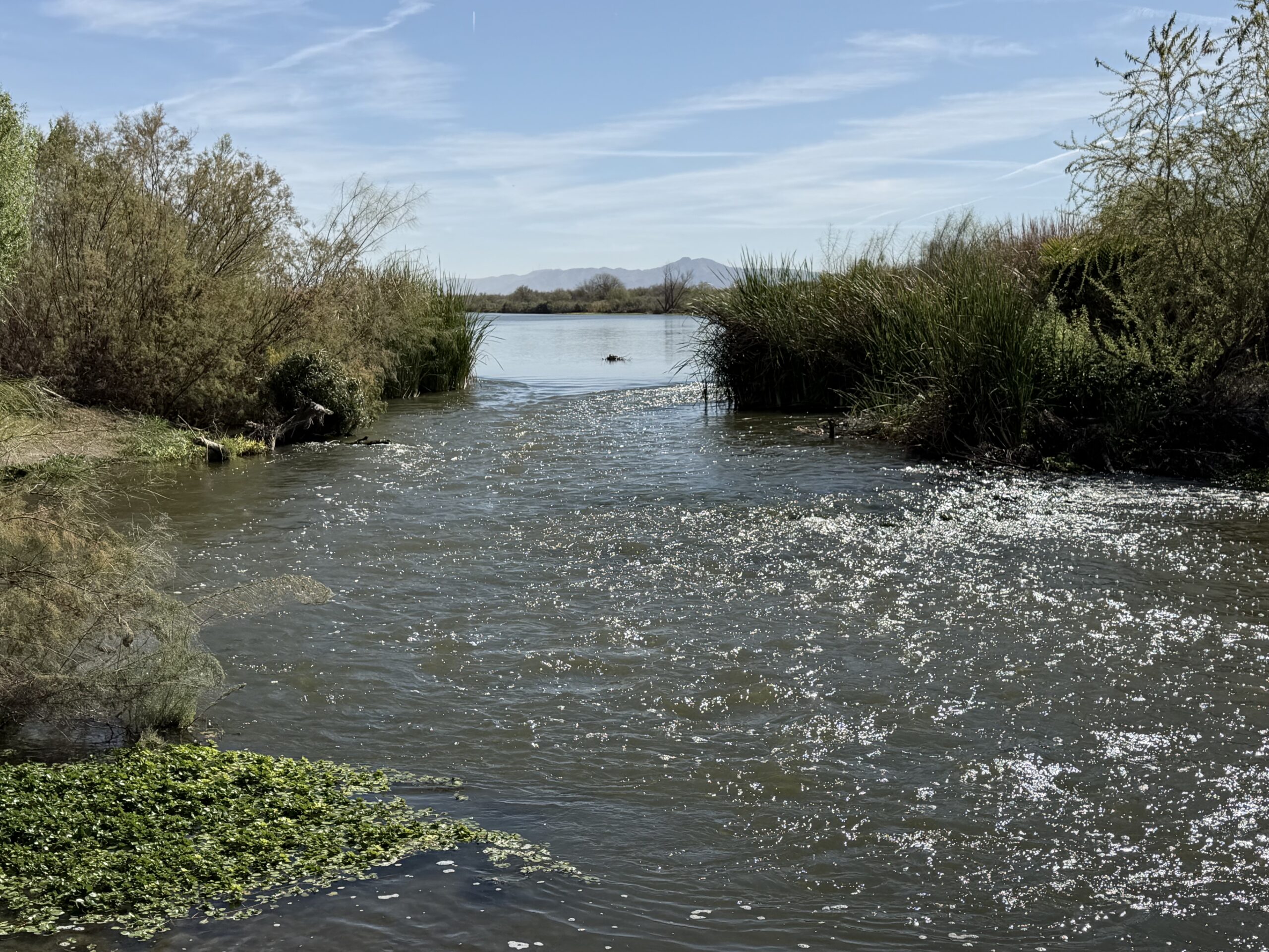
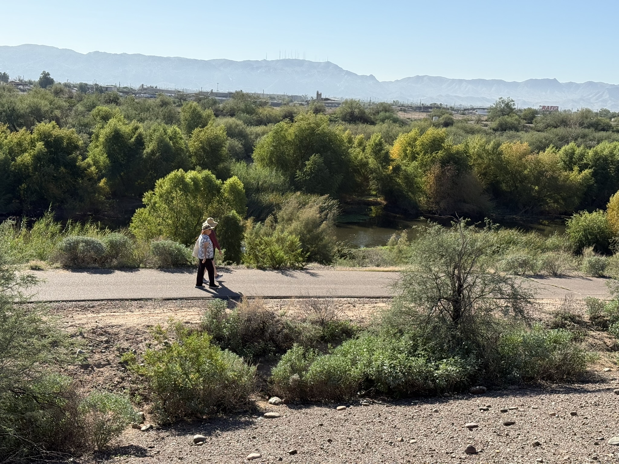
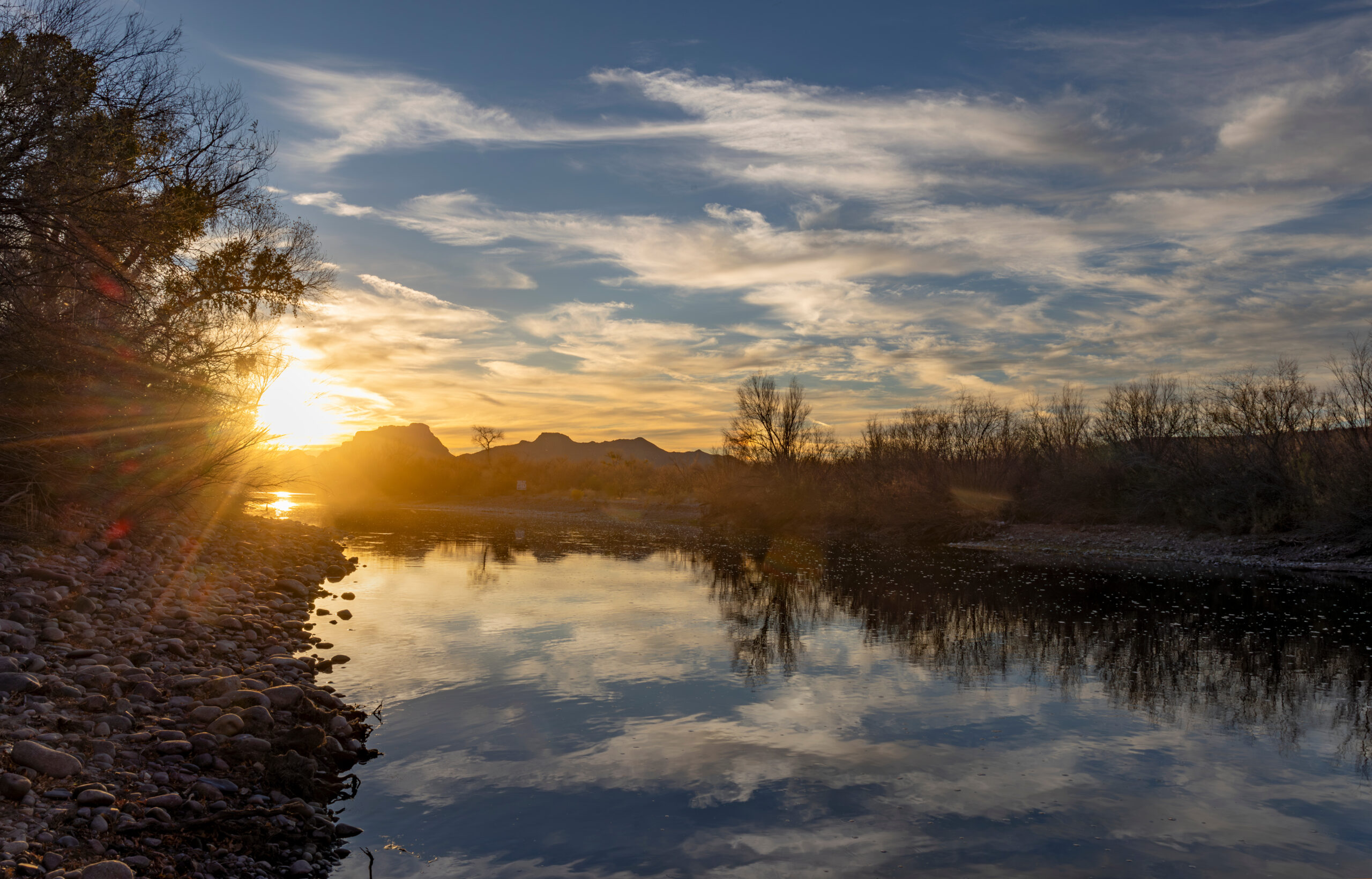
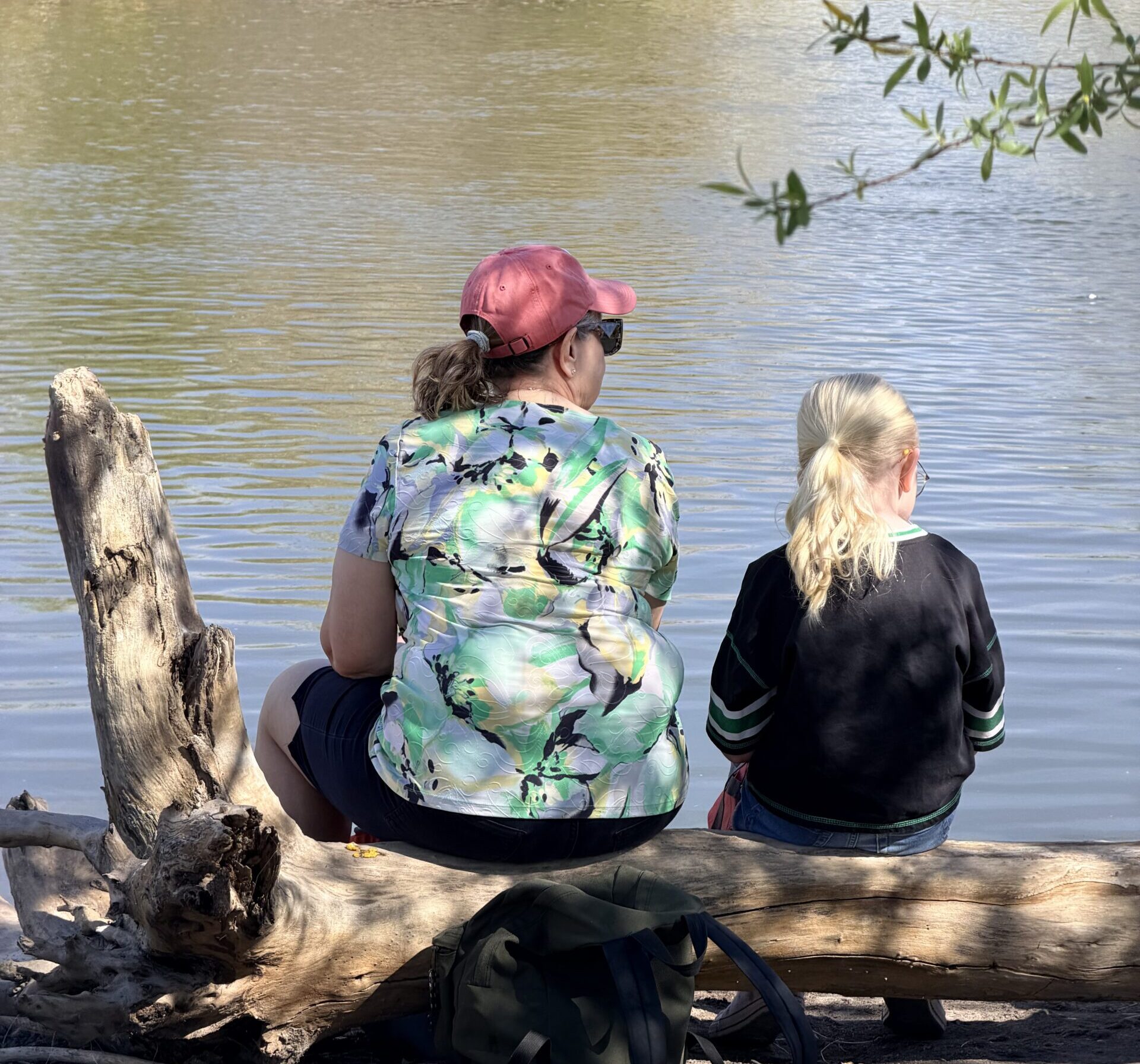
Explore photos taken from our site. Get a sense for the progress and beauty that takes place from this project.
Lorem ipsum dolor sit amet, consectetur adipiscing elit. Ut elit tellus, luctus nec ullamcorper mattis, pulvinar dapibus leo.
Learn More
Lorem ipsum dolor sit amet, consectetur adipiscing elit. Ut elit tellus, luctus nec ullamcorper mattis, pulvinar dapibus leo. Lorem ipsum dolor sit amet, consectetur adipiscing elit. Ut elit tellus, luctus nec ullamcorper mattis, pulvinar dapibus leo. Lorem ipsum dolor sit amet, consectetur adipiscing elit. Ut elit tellus, luctus nec ullamcorper mattis, pulvinar dapibus leo.
Lorem ipsum dolor sit amet, consectetur adipiscing elit. Ut elit tellus, luctus nec ullamcorper mattis, pulvinar dapibus leo.
Lorem ipsum dolor sit amet, consectetur adipiscing elit. Ut elit tellus, luctus nec ullamcorper mattis, pulvinar dapibus leo. Lorem ipsum dolor sit amet, consectetur adipiscing elit. Ut elit tellus, luctus nec ullamcorper mattis, pulvinar dapibus leo. Lorem ipsum dolor sit amet, consectetur adipiscing elit. Ut elit tellus, luctus nec ullamcorper mattis, pulvinar dapibus leo.